|
||
|
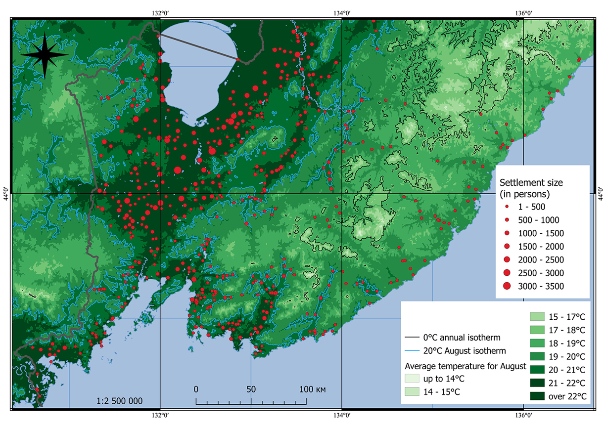
Average temperature for August in the South Ussuri Krai. Sources: (Populated and residential areas… 1915; Schematic map of the Iman Uyezd 1917; Schematic map of the Nikolsk-Ussuriysky Uyezd 1917; Schematic map of the Olginsky Uyezd 1917; Map of localities... 1913; Map of The Primorskaya... 1920; WorldClim, 1970-2000; Climate SSP 370S; RTM -30m; OpenStreetMap; Google Satellite; Google Road; Bing Aerial; opentopomap.ru). |