|
||
|
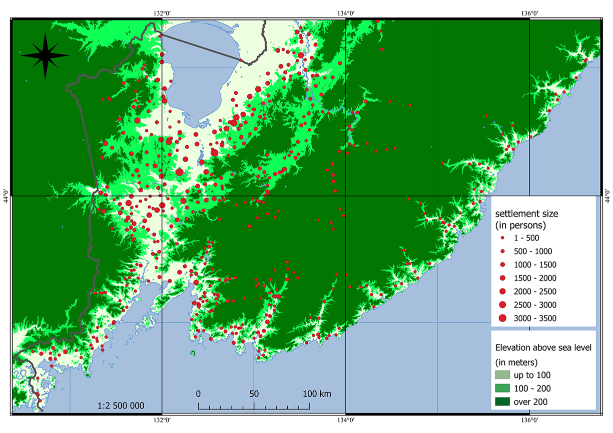
Distribution of rural settlements by elevation above sea level. Sources: (Populated and residential areas… 1915; Schematic map of the Iman Uyezd 1917; Schematic map of the Nikolsk-Ussuriysky Uyezd 1917; Schematic map of the Olginsky Uyezd 1917; Map of localities... 1913; Map of the Primorskaya... 1920; SRTM -30m; OpenStreetMap; Google Satellite; Google Road; Bing Aerial; opentopomap.ru). |